Saturday, July 5, 2025

This year, the Green Roof Infrastructure Network (GRIN) launched a groundbreaking project to bring climate action and resilience to communities across British Columbia (B.C.) through green roofs and green infrastructure. The first round of results have recently been released, revealing how this UK-based technology can now help towns and cities across North America strategically establish climate resilience, manage stormwater, and reduce vulnerability to urban heat, while protecting biodiversity.
What is GRIN?
The GRIN of BC was established in 2023 as a response to the discontinuation of green roof programming at the British Columbia Institute of Technology (BCIT), and to promote green roofs and green infrastructure in BC. Collectively, GRIN’s founding board members have over 160 years of experience working with green roofs. All are actively engaged in the industry (some for over 20 years) and most were involved at the BCIT Centre for Architectural Ecology (for example, through research and teaching courses). This depth of expertise grants GRIN with a sense of the industry, the state of research and understanding, and the challenges and opportunities for green roofs in the region.
One of GRIN’s purposes is to guide and support B.C. municipalities to develop and promote proactive policies that enhance biodiversity, reduce stormwater runoff, and improve climate resilience through urban greenery, including rooftops. So, in 2024, GRIN decided to map and assess the green infrastructure of BC towns and cities, specifically green roofs (existing and potential), private gardens and trees.
Mapping project for existing and potential green infrastructure
By creating a baseline map of existing and potential green infrastructure, communities can make informed decisions about nature asset management, which will influence liveability, biodiversity, and risks of urban heat, fire and flooding.
GRIN’s mapping project is conducted in partnership with Small Change Fund. A generous initial donation enabled the analysis of a 20 km2 area of interest (AOI) in the City of Vancouver. Framing is as a fundraiser means that more donations will enable GRIN to map – and empower – more B.C. communities.
What is unique and efficient about the project is the tool employed. Gentian software applies AI, computer vision, and high-resolution remote sensing to conduct rapid ecological surveys. Established in 2020 with funding from the European Space Agency, Vancouver is the first North American city mapped by Gentian.
Gentian was co-founded by Dusty Gedge and colleagues in London. Notably, it emerged from Gedge’s work mapping green roofs and potential retrofits for cities and towns in the UK using Google Earth. In addition to mapping and co-authoring the technical report for London’s green policy (2016), he has been a steady and effective advocate for green roofs and biodiversity in the UK and abroad. With Gentian, his influence now extends to North America.
With the aim of reversing the biodiversity crisis, Gentian’s goal is to put knowledge into the hands of decision makers to understand and realize the value from ecosystem services, and support sustainable business activities and urban planning.
Combining Earth Observation data with machine learning technology can automate ecological surveying, leading to significant reductions in risks, cost and time. Further to green roofs, the algorithms are fully-automated and work equally well across urban and rural environments. The image below shows the analysis of two buildings, one with extensive green roofs (green) and one with an intensive system (blue).

Project Results: Mapping Vancouver
The preliminary results are from the Vancouver mapping, which used very high resolution satellite imagery (30-50 cm) from summer 2023 to locate and analyze green roofs and vegetation. The building and private garden borders were determined using data from OpenStreetMap and British Columbia ParcelMap, respectively. Gentian’s AI models were then applied to the imagery within these borders to generate a detailed analysis of the green roofs, private gardens and trees across the 20 km2 AOI.
Of the 9,526 buildings mapped, 283 had green roofs, of which 83.8 per cent were extensive and 16.2 per cent were intensive systems. (The analysis does not include roofs with planters that are impermanent and not integrated into the roof structure.) The 283 green roofs identified cover nearly 100,000 m2, or just under two per cent of the otherwise impervious roofscape. The graphic below shows extensive and intensive green roofs as green and turquoise dots; intensive plantings (dark blue) are roofs with container plantings.

Since the most sustainable building is one that already exists, the study also analyzed green roof retrofit opportunities in the AOI. Retrofits were identified as inverted roofs (i.e., shingle and paved roof surfaces) (shown as white dots on the map below) and multi-storey car parks (brown dots) with a load-bearing capacity of at least 120 kg/m². Given that the estimate is based on a remote assessment, and restricted to inverted roofs only, these results are conservative meaning more retrofits are likely.

The economic significance of the retrofit analysis cannot be understated. Given their construction was already engineer-approved for 120 kg/m², verifying these roofs for a retrofit by a structural engineer will be straightforward and, therefore, economical. Obviously retrofits also need to consider other factors, such as roof access.
Key takeaways
This preliminary analysis shows that green roofs in the 20 km2 AOI cover a minimal surface area, even in an area with numerous renowned projects (e.g., Vancouver Public Library, Vancouver Convention Centre, Robson Square, Olympic Village, and Vancouver House). This means that green roof co-benefits here are restricted to building scale (e.g. cost savings for residents on air conditioning, cost savings for building owners on re-roofing). The wider benefits, like urban cooling and stormwater mitigation, can only be delivered when green roofs are implemented at scale.
The maps also illustrate the effectiveness of policy levers, the case in point being Vancouver Olympic Village in south-east False Creek. That area is easily spotted in the maps because of the dense cover of green roofs, as well as street trees, bioswales and meadows, which were part and parcel with the LEED Platinum goals of that development. An overlay of these maps with heat and acoustic maps would likely reveal that the Olympic Village is cooler than neighbouring communities.
For the next phase of mapping, GRIN is considering whether to analyze the rest of Vancouver or elsewhere in the province. Given our recent work on how green roofs and green infrastructure can protect fire-prone communities, we are thinking about mapping a semi-arid community in the Okanagan.
Now that the model is trained on a North American city, Gentian is ready to apply this service to other towns and cities across Turtle Island. To nominate other communities for this mapping initiative, click here.
Note for Giving Tuesday:
Make a donation of $10 or more to receive a tax receipt. While the surveys are quick and cost-effective, funding is required to pay for:
- proprietary satellite imagery;
- engineers to train the machine learning;
- generating and interpreting the data;
- translating data into action: ensuring the results get to the right people in the right places (municipal planners and other stakeholders).

Dr. Christine Thuring is an inter-disciplinary ecologist who has worked with green roofs since 2001. She holds an MSc from the Penn State Centre for Green Roof Research (2005), and a PhD from the Green Roof Centre at University of Sheffield (2016). She is the founder and executive director of the Green Roof Infrastructure Network (GRIN) of BC, and is based on the unceded territory of the Coast Salish people.
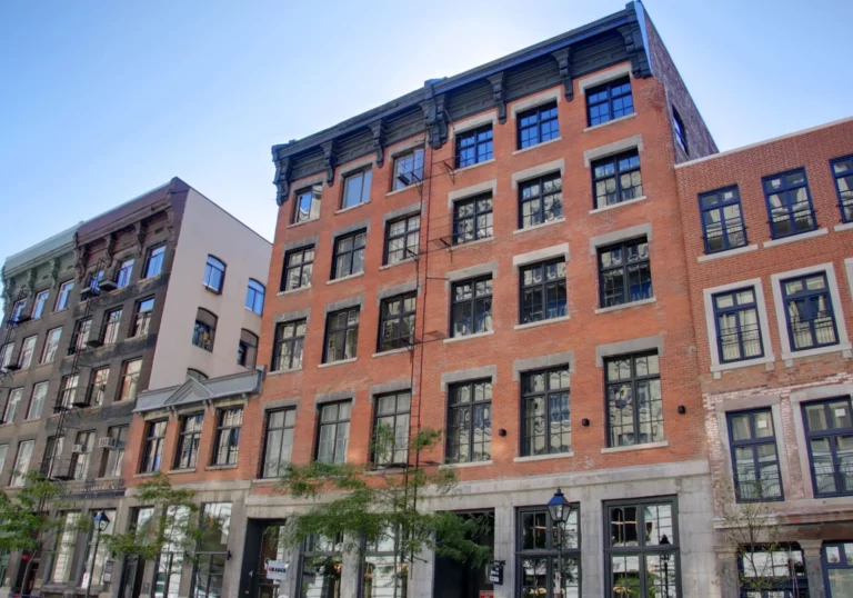
Featured image credit: Vancouver Convention Centre